Exactly one week ago, I started to watch an area of positive vorticity in the upper levels of the atmosphere.
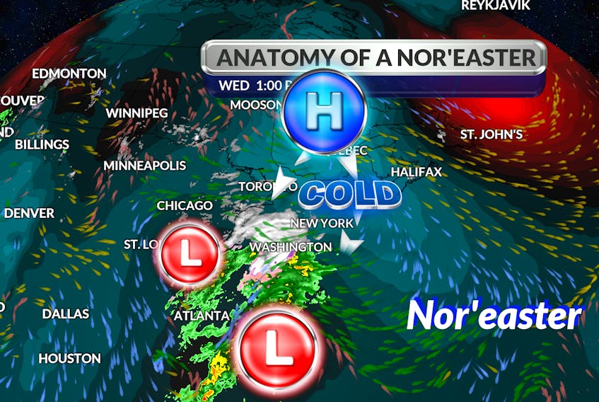
By Monday, the energy had developed into a surface trough. On Wednesday, the system had intensified to become a powerful nor’easter that will track south of Nova Scotia today.
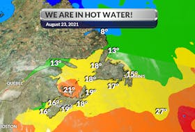
Every year at about this time, when these “East Coast beauties” start to show up on our radar, I get inundated with questions about them.
Before we go too far, let me remind everyone that first and foremost, a nor’easter is an area of low-pressure; like with every other area low-pressure system, the wind rotates in a counter-clockwise direction around its core - north of the equator.
Let’s have a look at what makes a low-pressure system a nor’easter:
There are two main components to a nor'easter: a Gulf Stream low-pressure system and an arctic high-pressure system.
Earlier this week, the developing system was over Texas. The storm tracked eastward reaching the southeastern U.S. coast on Wednesday; there it gathered moisture from the Atlantic.
Cue the other and very significant piece of the puzzle: the arctic high-pressure system. As the strong northeasterly winds pull the storm up the East Coast, it meets with cold air funnelling into the top of the system. When the two collide, the moisture and cold air produce snow, mixed precipitation, and even plain old rain. The type of precipitation depends on how close you are to the converging point of the two systems.
The arctic high that’s pushing down on the offshore low will keep the system’s warm core off our coastline; that means we’re on the snow side of this one. I do expect the storm to rotate a little overnight, allowing from some mild air and showers to move into eastern Cape Breton.
Curious minds want to know…
Earlier this month, I got an email from Rick; he had a question about rain. He was watching the forecast during one of our many nor'easters and noticed the storm travelled over the ocean. He wondered: “if the moisture that feeds the system is salty, what happens to the salt?”
The principal mechanism for weather systems to gain moisture from the ocean is evaporation, where water vapour is lost from the sea surface. During this process, the salt is left behind. The water is "distilled" and becomes nearly pure water vapour.
Not convinced? Try this little experiment. Dissolve some salt in warm water; put it in a saucer and leave the saucer on a windowsill. Eventually, the water will evaporate, and you will be left with salty sediment in the saucer.
Having said that…
In the case of a very strong storm like a nor'easter, there could be some slightly salty rain that develops. If the wind is strong, it can lift saltwater from the ocean's choppy surface and feed it into an updraft; it then becomes part of the cloud and the water cycle.
- Want more weather information? Visit your weather page.
- Have a weather question, photo or drawing to share with Cindy Day? Email [email protected]
Cindy Day is the chief meteorologist for SaltWire Network