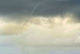
Last weekend, Cristobal become the third named storm in this very young Atlantic hurricane season.
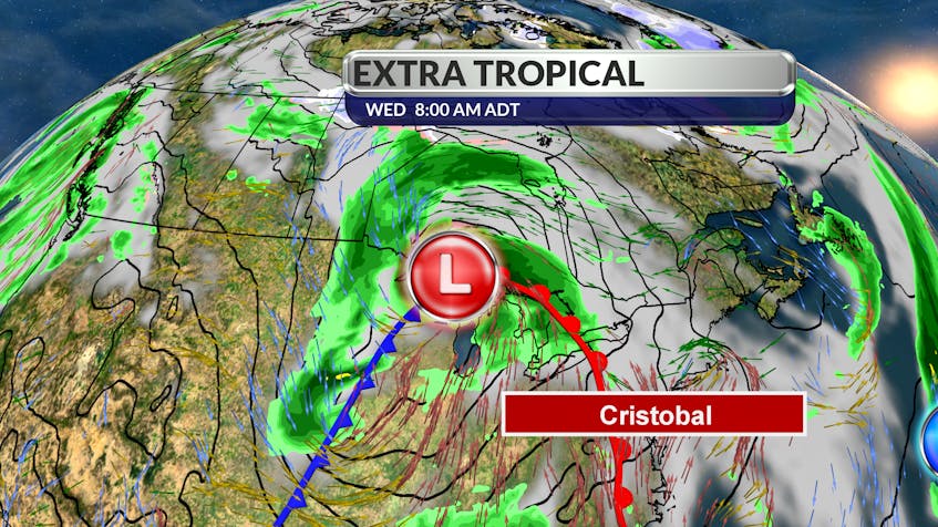
At 5 p.m. local time Sunday, the tropical storm made landfall over southeastern Louisiana. By Monday morning, the storm had been downgraded to a tropical depression. Remnants of Cristobal will cross the Great Lakes, Labrador and eventually end up near Greenland.
The storm has lost its tropical characteristics and has become extra-tropical. When I mentioned this yesterday, I immediately heard from a few of you asking me to explain the difference between a tropical storm and one that is extra-tropical.
The difference is fairly important since tropical systems have the potential to quickly grow into hurricanes, while extratropical storms do not.
Let’s start with the tropical cyclone. A tropical cyclone forms over a tropical ocean. Its centre is warmer than the surrounding air. It does not have fronts and the strongest winds are near the Earth’s surface. If conditions are right, it goes on to become a hurricane.
An extratropical cyclone, on the other hand, has cold air at its core and is driven by the release of potential energy when two very different air masses interact. The primary energy source is baroclinic, that is, results from the temperature contrast between warm and cold air masses. An extratropical cyclone can have winds as weak as a tropical depression, or as strong as a hurricane.
An extratropical cyclone - also called a mid-latitude cyclone - is a sprawling low-pressure system that spreads clouds, rain and wind over a large area. These storms always have one or more fronts connected to them and can occur over land or ocean.
This type of storm formation is common in the mid-latitudes (between 35 and 60 degrees latitude) off many coasts: the Atlantic, Pacific, near the Asian coast, even off the coast of Greenland – which seems to be where this one is headed.
One of Canada’s most infamous examples took place on Nov. 10, 1975. An extratropical storm on Lake Superior contributed to the sinking of the SS Edmund Fitzgerald near the Canada-U.S. border, 15 nautical miles northwest of the entrance to Whitefish Bay. It was a terrible Maritime tragedy, retold in the hauntingly beautiful song The Wreck of the Edmund Fitzgerald.
Now, I bet you’ll be humming Mr. Gordon Lightfoot's classic song for the rest of the day.
- Want more weather information? Visit your weather page.
- Have a weather question, photo or drawing to share with Cindy Day? Email [email protected]
Cindy Day is the chief meteorologist for SaltWire Network