Let me start by saying that the term “weather bomb” is real.
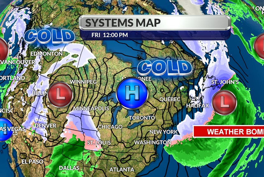
It’s a term given to a system undergoing explosive cyclogenesis. In other words, if the central pressure of a weather system drops more than 24 millibars in 24 hours or less, the storm can be referred to as a weather bomb. That explains the wind we’re experiencing today. In nature, everything flows from a high to a low.
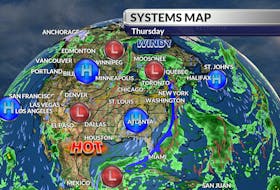
Cold air associated with the high-pressure system over Quebec is flowing into the deep low just south of the Avalon.

The lower the pressure, the faster the flow or wind will be; wind gusts are expected to reach 140 km/h just off the Avalon today.
Back to the cold high – its position is not ideal. It’s just far enough west of our region to allow another weather maker to roll through.
This one will track farther north and after a snowy Sunday morning, most of us will be on the wet side of things by Sunday afternoon.

- Want more weather information? Visit your weather page.
- Have a weather question, photo or drawing to share with Cindy Day? Email [email protected]
Cindy Day is the chief meteorologist for SaltWire Network