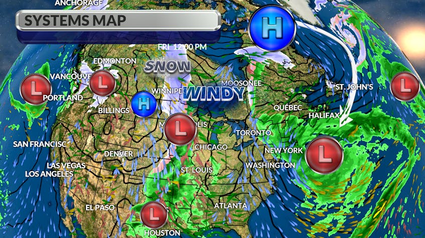
For four days now, there’s been a traffic jam in the atmosphere.
A clockwise circulation around a stationary high over Baffin Island has been feeding cold air down across the region and into a spiralling mid-latitude cyclone off the Eastern Seaboard. That atmospheric set-up is the reason for the persistent, not to mention raw, east to northeast wind.

By the end of the day today, that unusual weather pattern will begin to break down, allowing things to return to normal. The wind will diminish on Saturday, and we’ll be treated to more sunshine as the weekend goes on. Enjoy it.
The first weather-maker to track from west to east in about five days is going to push through with a mix of rain and snow. Totals are expected to be fairly low across the Maritimes on Monday. I’d expected close to five cm for southern Newfoundland late Monday to Tuesday morning. Sunshine returns following the fast-moving system.

- Want more weather information? Visit your weather page.
- Have a weather question, photo or drawing to share with Cindy Day? Email [email protected]
Cindy Day is the chief meteorologist for SaltWire Network