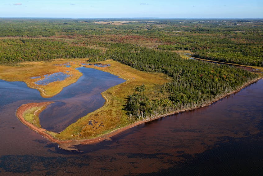
Nature Conservancy of Canada (NCC) wants people to have a better understanding of rivers and streams, including stressors human activity places on them.
Using the Watershed Assessment tool from their new blueprint, the NCC was able to determine stresses to freshwater health.
“In terms of P.E.I., a major stressor is the agriculture levels in the central part of the Island. It’s no secret that over the years there has been some significant fish kills in P.E.I., rivers because of pesticides and other toxins used in farming,” said Josh Noseworthy, the Director of Conservation Science with NCC.
The organization recently completed the Freshwater Conservation Blueprint, the first fully developed guide to freshwater regions in Atlantic Canada.
The database covers the Maritimes and eastern Quebec, including rivers that flow into the northern U.S.
Noseworthy said this has been an ongoing project for the NCC for the last few years.
“It’s been a three-year research project, with the core team made up of 20 freshwater conservationists. It’s been the largest undertaking we’ve had.”
The NCC created the blueprint to give its users an understanding of how our rivers and streams function.
“It’s like the name suggests, a blueprint. For where the most important places are for freshwater conservation, what we can do to improve and restore species’ habitats,” said Noseworthy.
Noseworthy added the information is vital to the protection of freshwater rivers and streams in the Maritimes.
“It can be used to keep track of endangered species. Their migration patterns. Which parts of a region might have more activity, or if a section needs more attention.”
Freshwater facts
- One in three freshwater animals are threatened with extinction across the globe.
- 60 to 80 per cent of the culverts in rivers and streams are barriers to fish and aquatic wildlife.
- NCC has helped to protect a total of 2,350 hectares (5,800 acres) on P.E.I., owning 750 hectares (1,850 acres) of that land, including a nature reserve along the Percival River in Egmont Bay.
Kathryn Morse, NCC’s Atlantic Director of Communications, said the blueprint can help many organizations.
“Anyone can use it. Universities, governments or anyone in the community can use these tools that provide in-depth information about P.E.I.’s freshwater streams, rivers and body of water that hasn’t been available before.”
The blueprint uses stream and river classifications, mapping every river and stream and classifying them under habitat types. This tool can help predict what kind of wildlife inhabiting these regions.
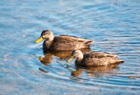
Many aquatic species are on the Species at Risk list, over 600 aquatic plants and animals in Canada alone. Certain P.E.I. species are of special concern, like the Atlantic Salmon and American Eel.
“This tool is significantly important to wildlife conservation if organizations want to pinpoint what species are where. It helps us predict where diversity occurs,” said Noseworthy.
This is only the beginning for the NCC’s efforts in freshwater conservation in the Maritimes.
One aspect of the program is aquatic connectivity, a tool mapping every dam, culvert and potential barrier to fish and other wildlife.
“Barriers like culverts have become a significant threat to freshwater wildlife. This tool can help prioritize which are the most important barriers to restore and improve fish passage.”
Aquatic connectivity is rising in the conservation world, and the NCC hopes this can be useful.
“We’re really excited about this one, it’s a global movement happening right now to move obsolete dams and creating bypasses for freshwater species. We hope there’s a lot of uptake in this tool,” said Noseworthy.
NCC’s next step in developing the blueprint is adding a database for endangered species.
The freshwater conservation blueprint is accessible at: 2c1forest.databasin.org