<img height="1" width="1" style="display:none" src="https://www.facebook.com/tr?id=288482159799297&amp;ev=PageView&amp;noscript=1">

Web Notifications

SaltWire.com would like to send you notifications for breaking news alerts.

Activate notifications?

Saltwire Logo

Welcome to SaltWire

Register today and start
enjoying 30 days of unlimited content.

Get started! Register now

Already a member? Sign in

Major storm could hit P.E.I. Jan. 20

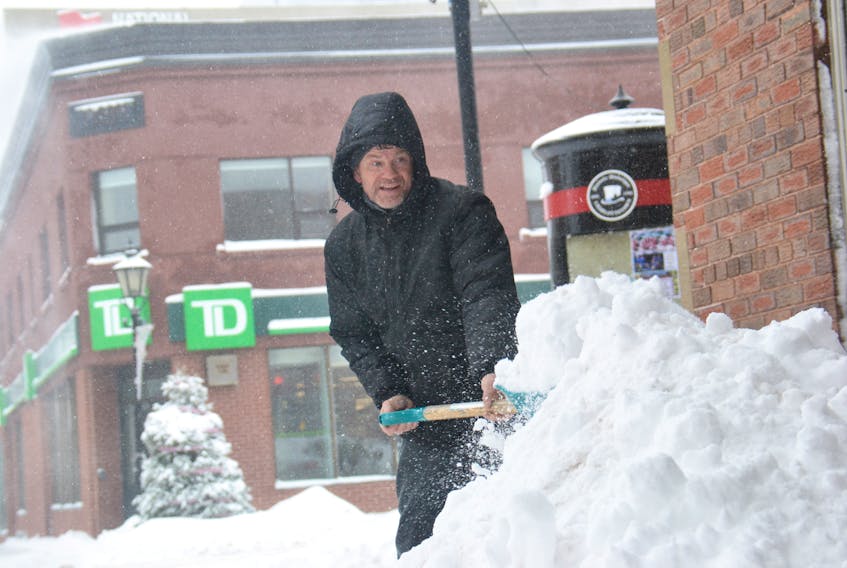
Billy Mitchell, the manager of the building on 187 Queen St. in Charlottetown, clears up the snow from another storm on Wednesday, Jan. 9, 2019.
Billy Mitchell, the manager of the building on 187 Queen St. in Charlottetown, clears up the snow from another storm on Wednesday, Jan. 9, 2019. - File

STORY CONTINUES BELOW THESE SALTWIRE VIDEOS

Bud the Spud hits the road | SaltWire

Watch on YouTube: "Bud the Spud hits the road | SaltWire"

Environment Canada has issued a special weather statement for all P.E.I. for Sunday night, but whether the province will see rain or snow remains unclear at this time.

The weather agency said Wednesday that a low-pressure system will approach the region from the southwest Sunday and track across the Maritimes as a large winter storm Sunday night.

While it is difficult to give details this far in advance, Environment Canada said all indications show a major snowfall event for areas north of the track of the low, a major rainfall event south of the track of the low and significant amounts of snow, rain and potential for an extended freezing rain event near the track of the low.

The precipitation will be accompanied by strong east to northeast winds ahead of the low's track, shifting to strong southerly winds south of its track.

Snowfall amounts of 30 cm or higher are possible north of the low's track. Rainfall amounts south of the track in excess of 50 mm are possible.

Potential tracks of this system currently range from central New Brunswick to the Atlantic Coast of Nova Scotia.

“Because the track of the low will be critical in determining how much snow, rain or freezing rain any location will get, even a slight shift in its track will have major effects on the type and amount of precipitation received,” Enviornment Canada said, adding details should become more clear over the next couple of days as the system gradually develops over the southern United States.

For more weather from SaltWire Network meteorologist Cindy Day, click here

It has been our privilege to have the trust and support of our East Coast communities for the last 200 years. Our SaltWire team is always watching out for the place we call home. Our 100 journalists strive to inform and improve our East Coast communities by delivering impartial, high-impact, local journalism that provokes thought and action. Please consider joining us in this mission by becoming a member of the SaltWire Network and helping to make our communities better.
Share story:
ADVERTISEMENT
ADVERTISEMENT
ADVERTISEMENT

Local, trusted news matters now more than ever.
And so does your support.

Ensure local journalism stays in your community by purchasing a membership today.

The news and opinions you’ll love starting as low as $1.

Start your Membership Now